TCTrail
Previous Posts
- St John's branch 2
- Kettle Valley - 07 March 2008
- Nashwaak subdivision
- Tormentine subdivision
- Port aux Basques subdivision
- St John's branch
- Whitbourne branch
- Smiths Falls sub 2
- Maniwaki sub 3
- Maniwaki sub 2
Friday, May 26, 2006
Ste-Agathe subdivision
Campbellford subdivision
Kingston subdivision (CPR)
 Engine 1095, the Spirit of Sir John A (4-6-0 built in Kingston 1913) rests oustide Kingston's inner station.
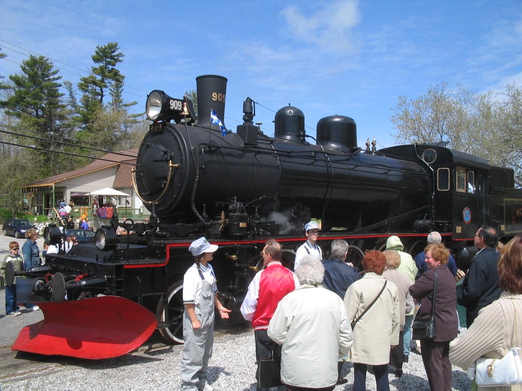
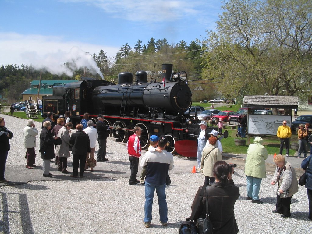
The Kingston & Pembroke railway eventually became part of the CPR system as the Kingston subdivision. From Kingston, the line through to Sharbot Lake was constructed by 1875 (to Mississippi in 1877, to Lavant in 1881 and to Renfrew in 1883). The CPR measured the miles south from Pembroke. The Trans Canada Trail will occupy the rail bed north to Sharbot Lake where the trail then heads west on the former Havelock subdivision. The rail between Sharbot Lake and Tichborne had been abandoned by 1964. South of Tichborne, the steel was removed by the end of 1986. The turntable from the K&P's Kingston station lives on in Wakefield, Québec, turning the excursion steam train. See the photographs in post concerning the Maniwaki subdivision.
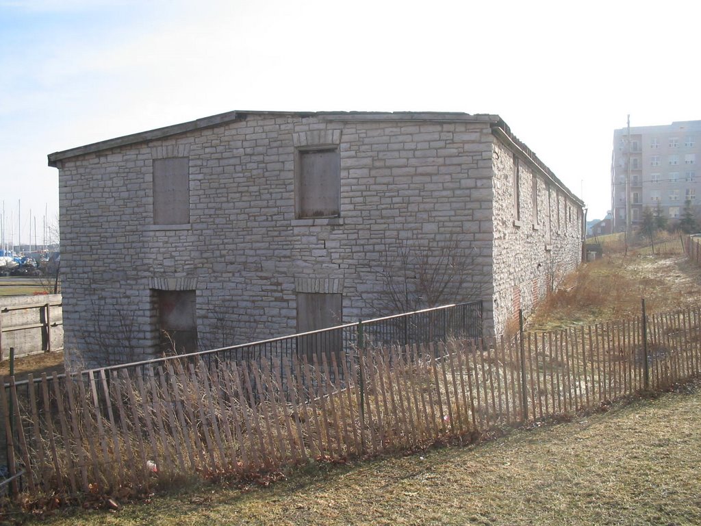
The turntable and round house are long gone but the nearby stone-construction oil warehouse still stands (2006).

The trains once supplied Quattrocchi's fruit and vegetable warehouse at Montreal and Railway streets, 1.4 miles from the inner station.
The right-of-way crosses Sydenham Road 5.1 miles from the inner station.
.0.jpg)

Highway 401 can be seen on the far right (north), six miles from the inner station.
Havelock subdivision
Maynooth subdivision
Carleton Place subdivision


The Ottawa-Carleton Trailway (and the Trans Canada Trail) occupy the rail bed from behind Fitzgerald Road in Bells Corners through to Carleton Place. This portion of the line had not been abandoned until 1990. HISTORY OF THE LINE A track from Ottawa to Carleton Place was built by the Canada Central Railway Company, opened to traffic in 1870 and became part of the Canadian Pacific system when CP took over the Canada Central Railway Company in 1881. The track between mile points 1.4 and 8.1 was ordered abandoned in 1967 by the Board of Transport Commissioners Order No. 125356; trackage from mile point 0.84 to 1.4 was abandoned in 1970 by Order No. R-9675 of the RTC of the CTC. LOCATION OF THE LINE A map of the area is attached. The Carleton Place Subdivision is located in and to the west of Ottawa, Ontario. The subdivision commences at Bells Junction at mile 7.5 in the Ottawa suburb of Nepean and runs westward to a point near Carleton Place, (Mileage 28.1) where it connects with the CP Chalk River Subdivision. The stations located on the line are Stittsville, Ashton and Carleton Place. CONDITION OF THE TRACK Generally, the track can be described as in good condition. All of the rail is 100 lbs type of which approximately 18.7 miles were rolled and laid in 1975. The remainder of the rail was rolled in 1929 and laid in 1930. The ties are treated softwood and are in fair condition. The ballast is crushed rock. The drainage is regarded as adequate. The permissible speed is restricted to a maximum of 75 miles per hour for passenger trains and 45 miles per hour for freight train operations. SERVICES ON THE BRANCH LINE VIA Rail Canada Inc. (hereinafter VIA) operates a passenger train service daily on this Subdivision. Its train "The Canadian" uses this branch line as part of its transcontinental route. The train has scheduled stops once each day westbound and eastbound at Ottawa and Carleton Place. In contrast, freight train service is only available "as and when required" due to the absence of demand for this service. CARLOAD TRAFFIC Carload traffic has been nearly non-existent over the past four years...
Monday, May 22, 2006
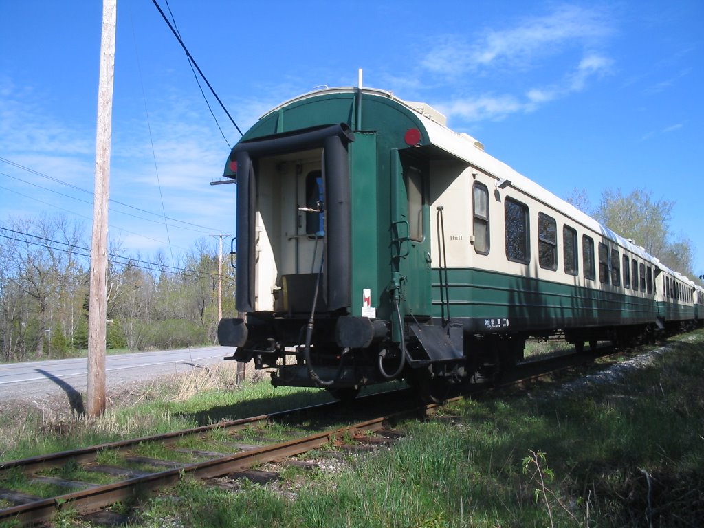
Maniwaki subdivision

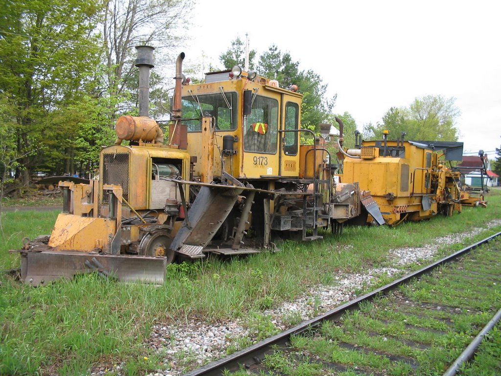
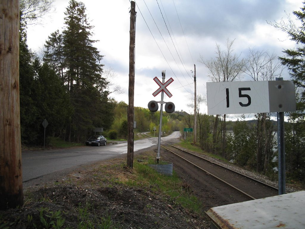
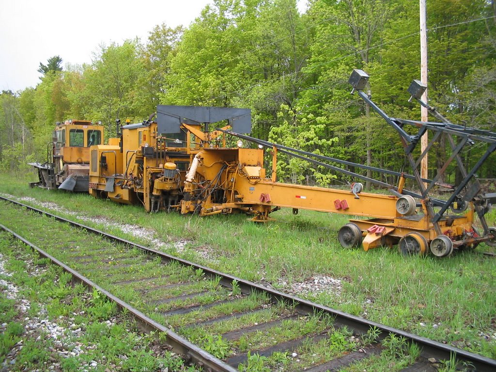 Rail maintenance equipment (Pyke 9173) rests in the siding at Chelsea (mp 6.5).
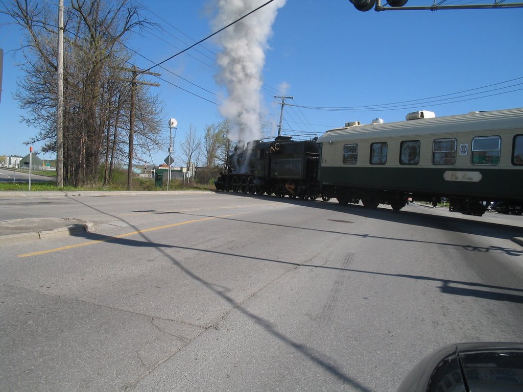
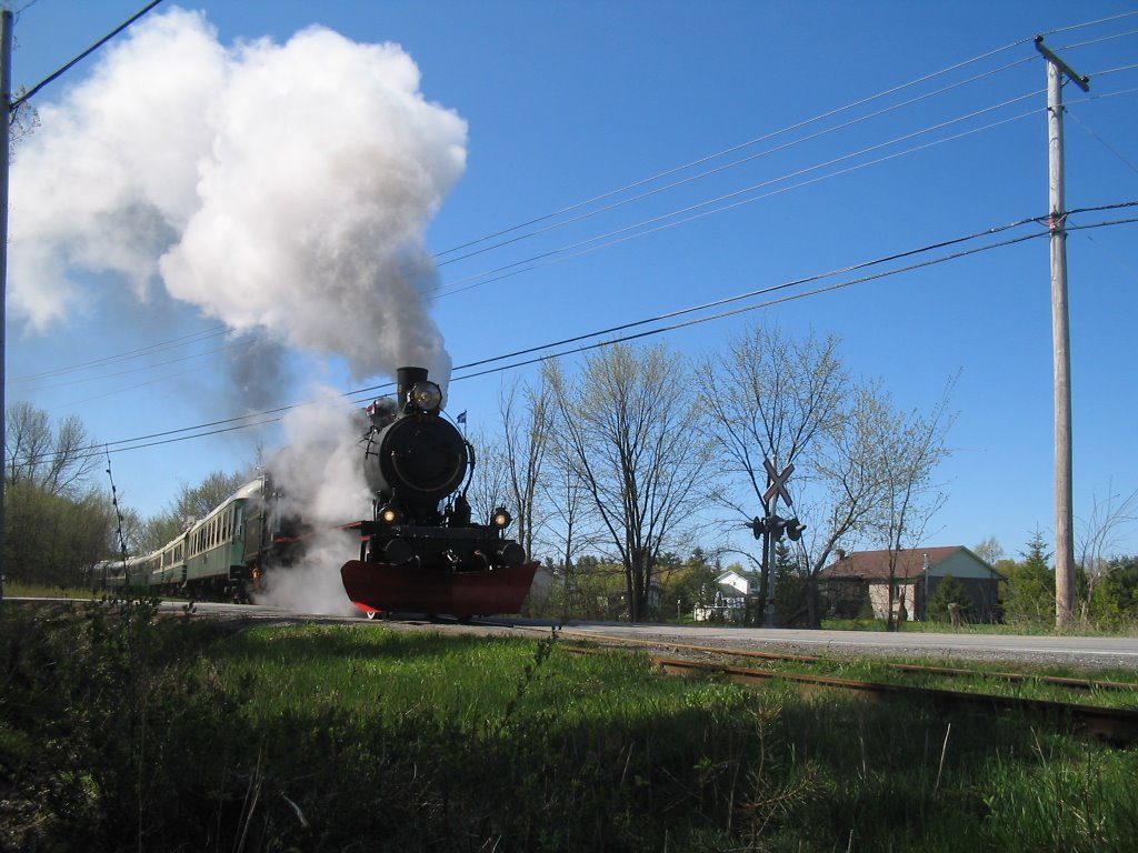
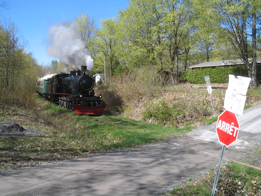
The Wakefield steam train is southbound as it passes the switch at the south end of the siding at Chelsea.
Rail maintenance equipment (Pyke 9173) rests in the siding at Chelsea (mp 6.5).
The Wakefield steam train is southbound as it passes the switch at the south end of the siding at Chelsea.


Behind the bridge, the mine (and its spur, closed since 1969) can still be seen.


Archives
April 2006 May 2006 June 2006 September 2006 May 2007 June 2007 November 2007 July 2008
![]()